

The First Atlas
Manūscriptum: Edition VI

Welcome to Cosmographia. This post is part of our Manūscriptum series, where we take a look at some of history’s most beautiful documents. For the full map of Cosmographia posts, see here.
The fifty year period between 1550-1600 is often called the golden age of cartography. The European powers were sending out ever more exploratory expeditions, new territories were being colonised in Africa, Asia, and the Americas, and stories of new and strange lands were coming back to the mother continent in a flood. As such, the mapmaking trade became ever more important to the monarchs, merchants, and scientific institutions of Europe, and certain cartographers even gained great wealth and fame as their commissions became greatly sought after.
Dutch and Flemish mapmakers were in particular demand. They had developed a reputation for the world’s finest maps after setting new standards of accuracy, developing innovative new protection systems, and including ever more refined geographical knowledge in their depictions of the world. Entire cartographic dynasties were established as the workshops run by the Blaeu, Visscher, and Hondius families produced maps for the merchants, navies, and libraries of Europe over the course of multiple generations. But even these didn’t come close to the two most famous mapmakers of the Netherlandish School: Gerardus Mercator, inventor of the projection system still used on most maps to this day; and Abraham Ortelius, creator of the first modern atlas — a book of maps.
Ortelius lived and worked in Antwerp for the entirety of his 71 years of life. In 1547, at the age of 20, he became a member of the local guild of St Luke, where he was first employed as an illuminator of maps — essentially to draw and decorate charts. This, however, was not enough to support the entire Ortelius family, a burden which Abraham had had to take on after his father had died. For extra money, the young cartographer took to trading in the maps themselves, buying up cheaply-made charts, mounting them on boards, and embellishing them with his illumination and engraving skills, before selling them on for a profit to the Flemish middle class. It was one such middle class customer that first seeded the idea that would make Ortelius’ name.
Aegidius Hooftman, a local merchant, complained to his assistant Radermaker how cumbersome it was to have to assemble a collection of various maps and charts in order to conduct his business overseas. Ortelius spotted a product opportunity and began to assemble a group of maps that could all be printed and bound together in a single volume. The trick was for it to be large enough to contain plenty of useful detail, but small enough to be convenient to carry on ships or keep in an office.
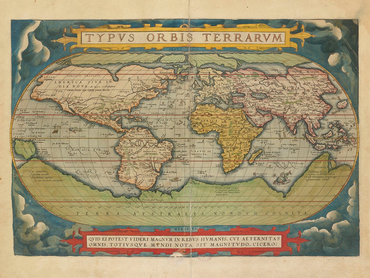
Apparently, Ortelius knew Mercator, who was older and more established, and discussed with him his idea of a book of maps. Mercator happened to be working on the exact same concept, though was magnanimous enough to encourage the younger cartographer. It took Ortelius a full decade’s worth of work, but in 1570 he was finally ready to publish his Theatrum Orbis Terrarum (Theatre of the Globe of the World). The first edition contained 53 maps, which Ortelius had compiled from the works of some 87 of Europe’s finest mapmakers — a list which he included in full in his introduction so as to boost his own credentials. He took care not to ruffle the wrong feathers, making sure he didn’t include any engravings that may offend the Church, or include any maps with coats-of-arms of those on bad terms with the Spanish crown, which still ruled much of the Low Countries at this time.1
Theatrum was an immediate commercial success. The convenience of the pooled knowledge in an easily transportable package suited its intended market perfectly, and moneyed middle-class merchants, ship captains, and those just interested in the latest knowledge and science gobbled up Ortelius’ work. During the course of his lifetime, Theatrum ran to 28 editions and was translated into seven languages (the initial run was only available in Latin). Ortelius was a shrewd businessman, and each new edition was updated with the very latest knowledge — which was coming back to Antwerp via returning ships all the time — meaning old editions quickly obsoleted and customers would be incentivised to purchase the latest version (Apple didn’t invent obsolescence, you know). By the time the Italian edition came out in 1612, the book contained more than 100 maps — more than double the original version. (A particularly beautiful copy from 1603 is today worth £135,000.)
You may have noticed that nowhere in its title does Theatrum mention the word ‘atlas’ — this was a name given to the format by Mercator, who didn’t manage to get his book of maps completed for another 25 years. The name of course comes from the Greek Titan, Atlas, who held up the heavens and was the mythical King of Mauritania; Mercator believed him to be the first great geographer. He wrote to his friend, Ortelius, “I compliment you on the care and elegance with which you have embellished the labours of the authors, and the faithfulness with which you have preserved the production of each individual”.
Below, I’ve compiled a collection of some of the best maps from the various editions of Theatrum, along with some notes on what to look out for in each. Enjoy.

Europe
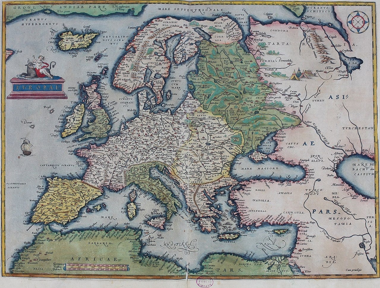
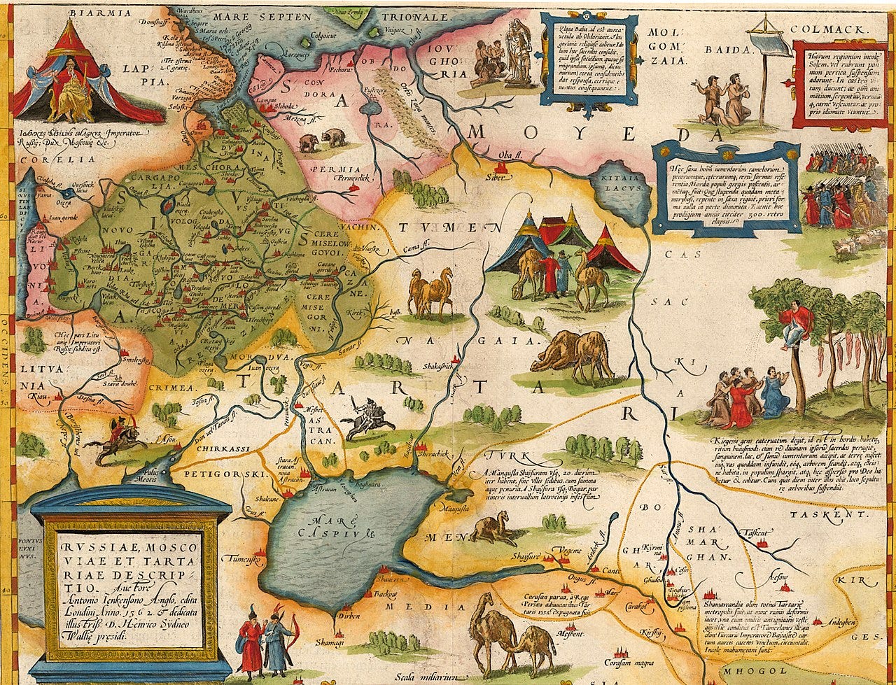
The cartouche (upper left) depicts Europa, the Phoenician princess after whom Europe is named, being abducted by Zeus disguised as a bull. Also notice the tents of the nomadic ‘Tartars’ beyond the forests of Eastern Europe.
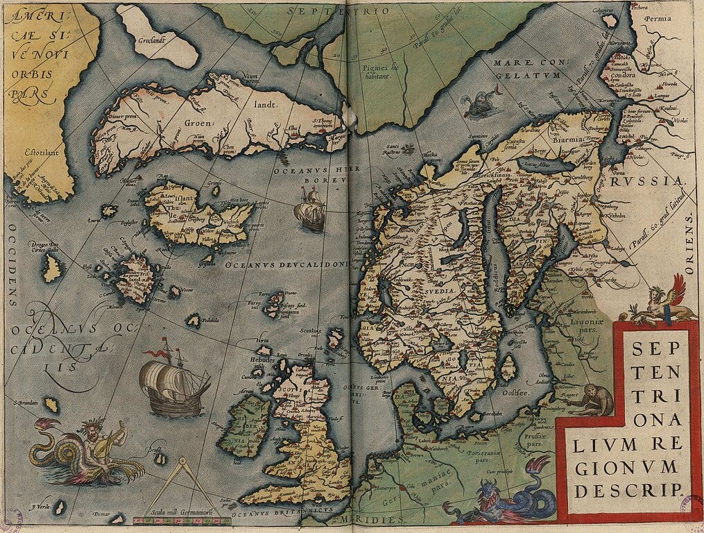
This map of Northern Europe and the Atlantic is interesting for a few reasons. Iceland is marked ‘Thule’ — mythical island of the far north, first reported by Pythias in the 3rd century BC. Just below it is marked the island of ‘Frisland’ — a cartographic phantom that appeared on all maps of the North Atlantic for over a century.
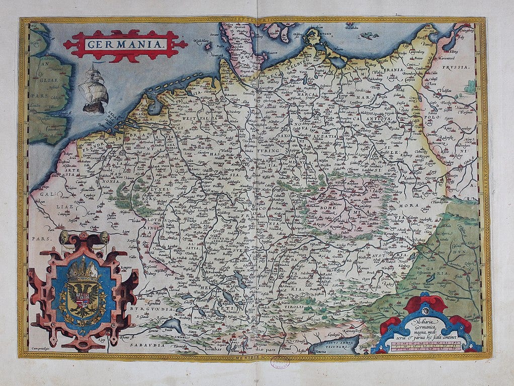
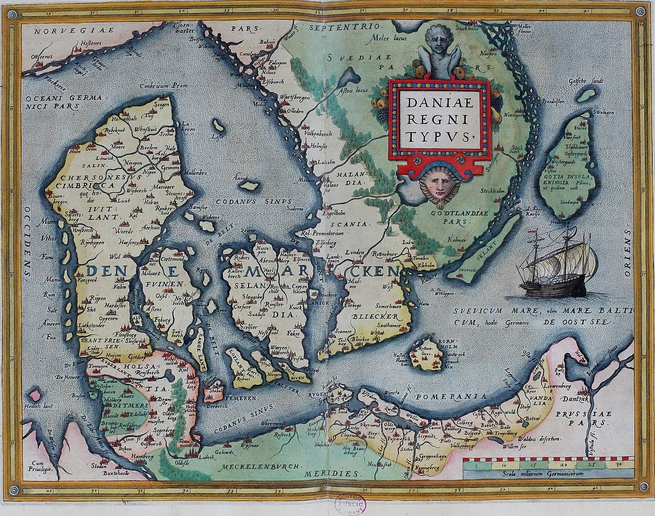
Many of the cities depicted here were part of the Hanseatic League, the trading network which had by Ortelius’ time begun to go into decline.
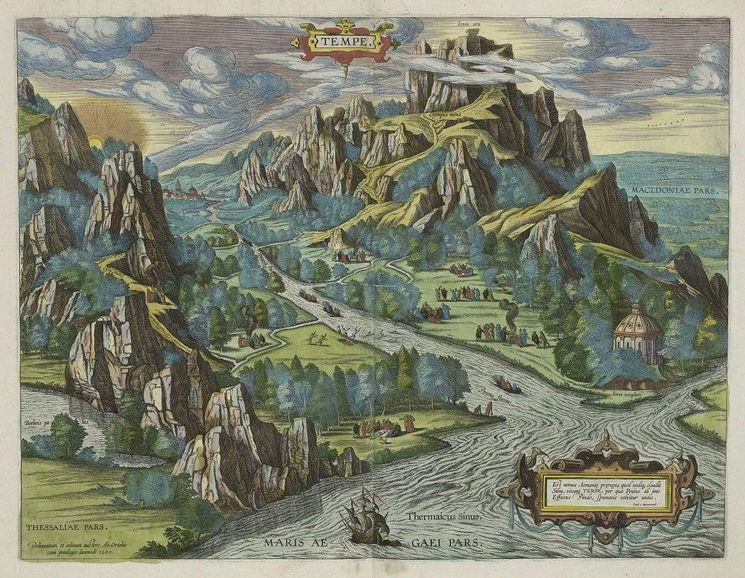
The Greeks believe the Vale of Tempe was cut by Poseidon himself, and was a favourite place of Apollo and the Muses.
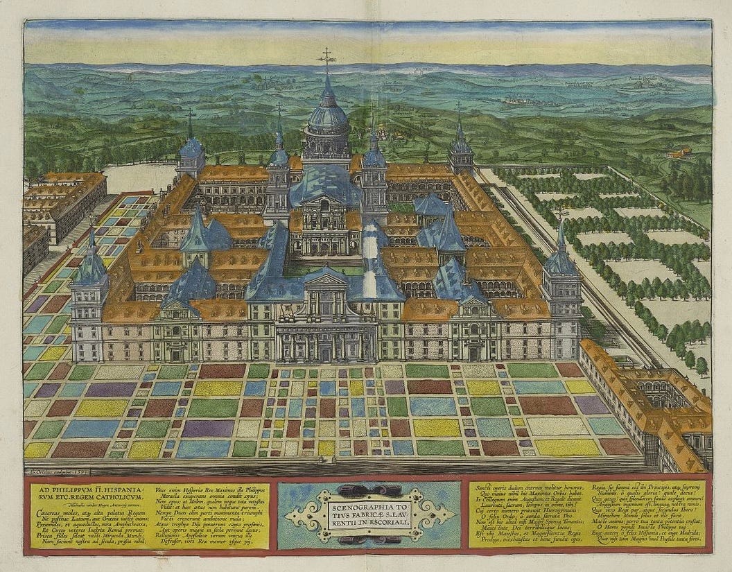
The Royal Site of San Lorenzo de El Escorial had recently been built on the order of King Philip II of Spain, and was supposedly built according to descriptions of the Temple of Solomon in the Bible.
No good atlas is complete without a depiction of Neptune, in my opinion.

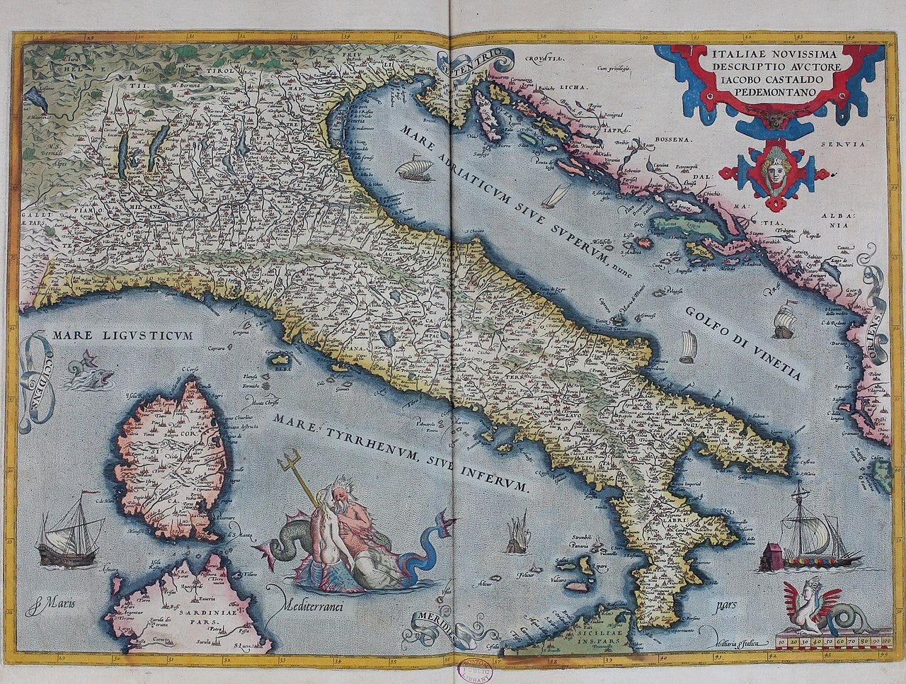
Africa
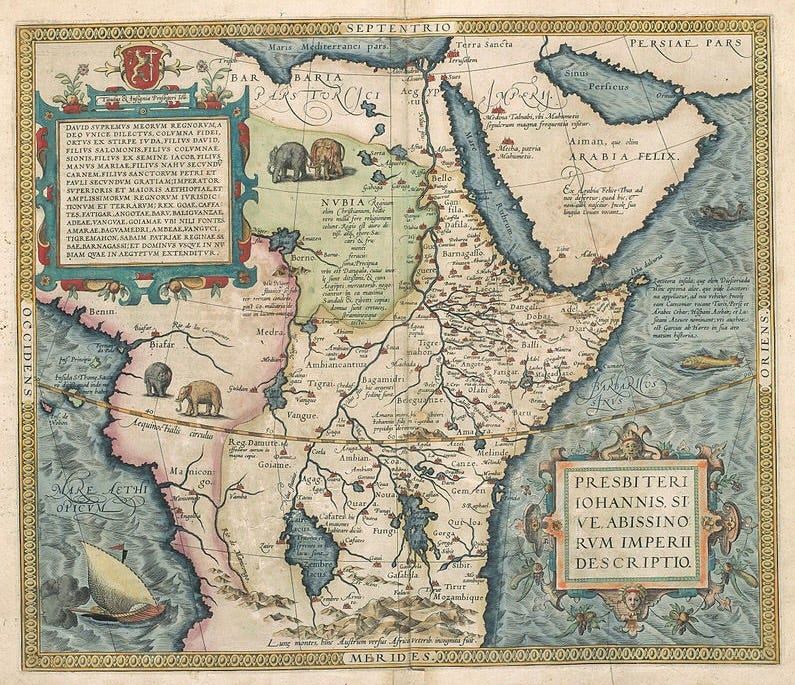
Notice the mythical Prester John’s Christian kingdom and the Montes Lunae, legendary source of the Nile.
Ortelius covers up his lack of knowledge about Africa’s interior by overlaying it with a rather extravagant cartouche. The curiously straight Nile is a cartographic tradition going back to Claudius Ptolemy of the 1st century.
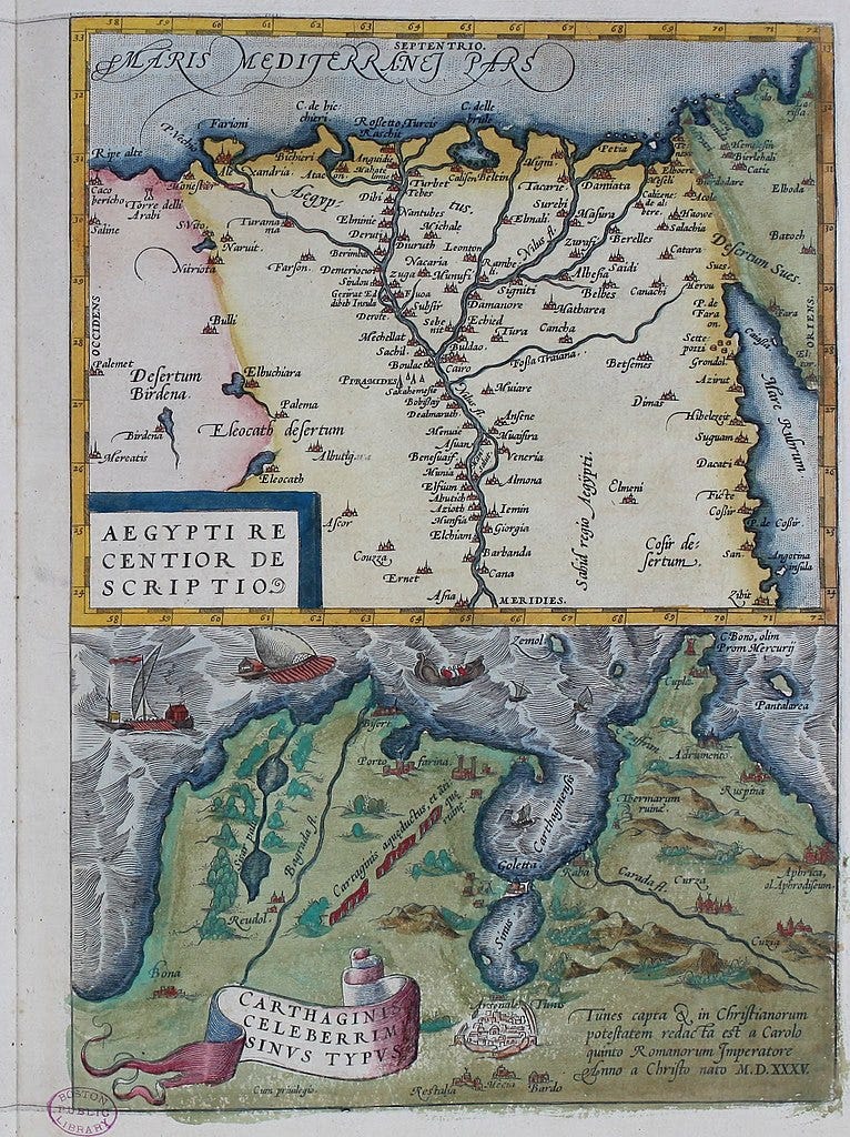
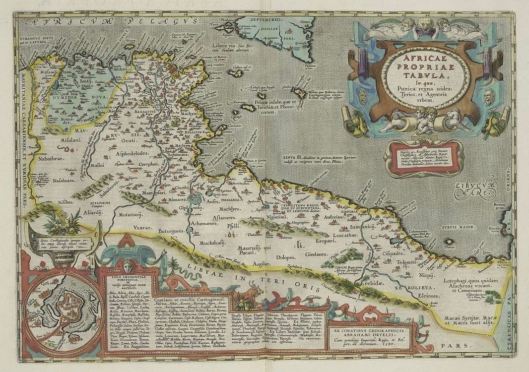
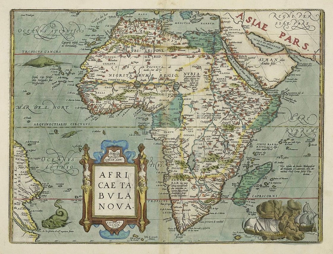
There are more than a few fictional lakes drawn in Africa’s interior, but at least we get a few sea monsters.

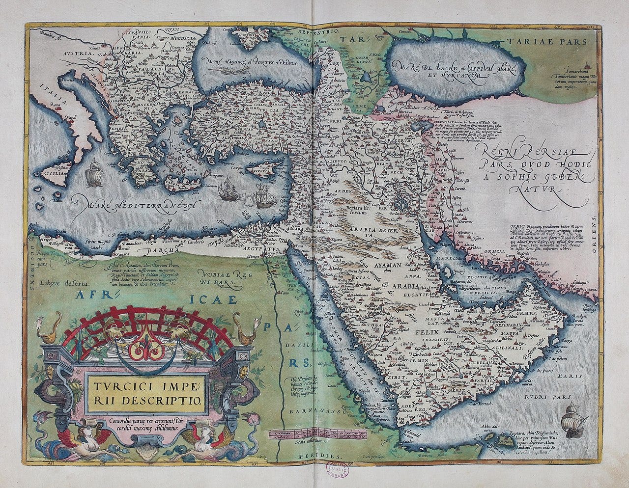
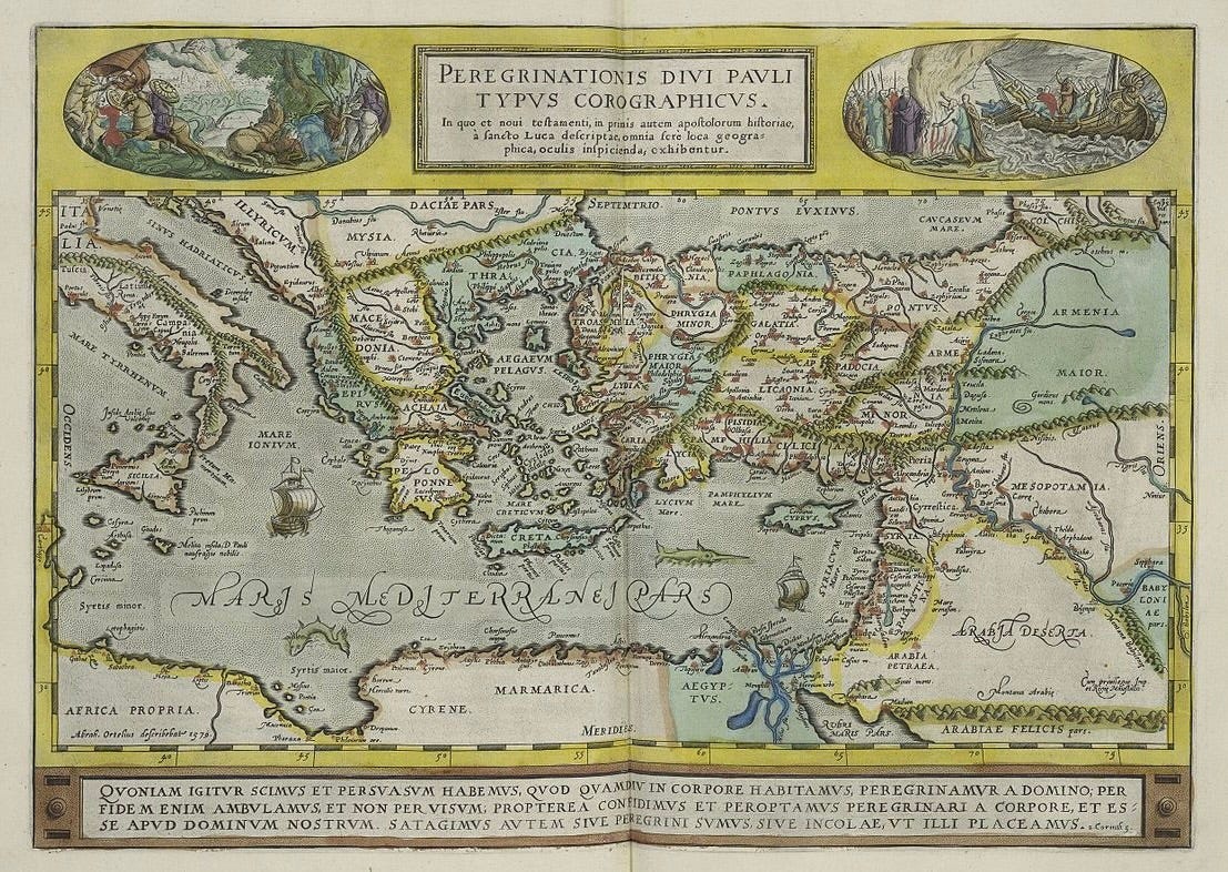
Asia
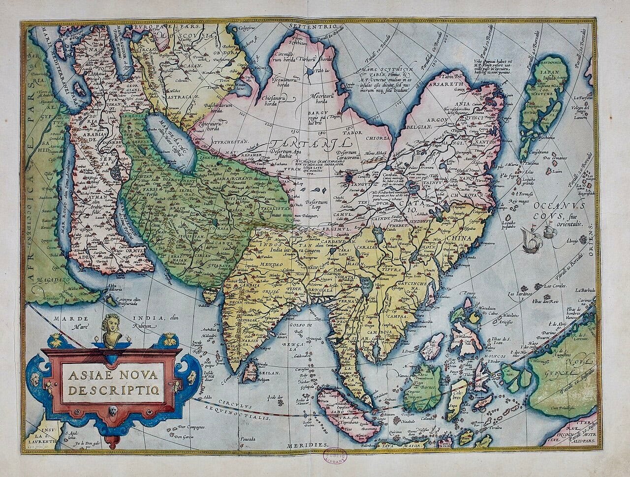
Marco Polo’s name appears many times on the map of Asia. Look to the far north of ‘Tartaria’ (Land of the Tartars) to see various ‘horda’ — Tartar hordes. Notice too, at far northeastern edge of the continent, the land marked ‘Ania’, a country named in Polo’s Travels, and once believed to lie next to the mythical Strait of Anián, entrance to the long-sought Northeast Passage. Look how far north and misshapen Japan is, which at this time was closed to all but a very few foreigners.
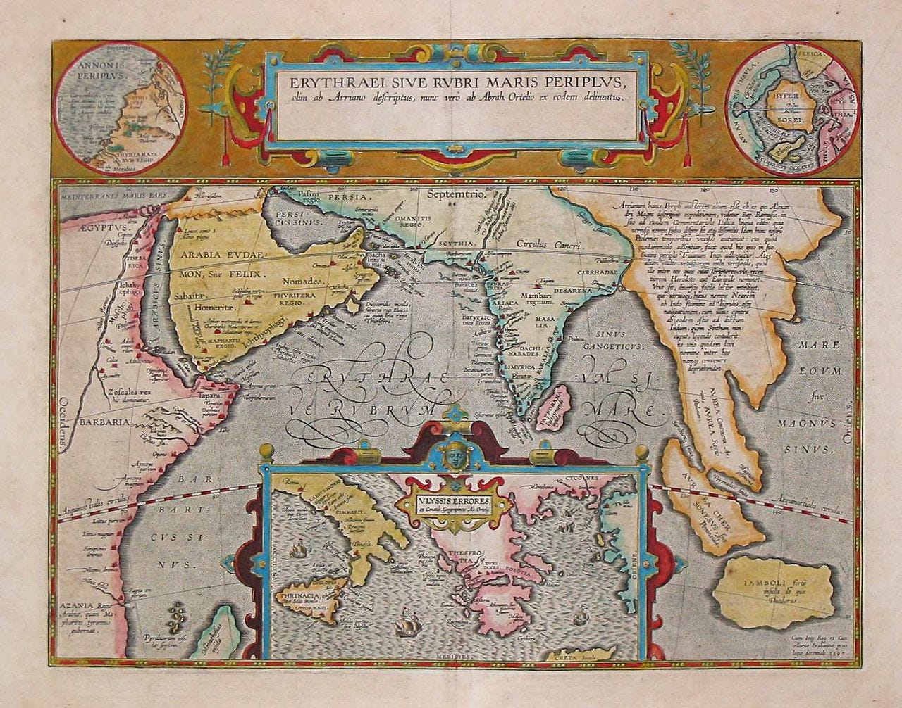
Ortelius labels this map the “Periplus of Erythraean Sea”, which refers to an ancient Greco-Roman manuscript (c. 50 AD) detailing the trading and navigation opportunities between the Mediterranean and India. Hence we have both the Indian Ocean and southern Italy and Greece on the same map.
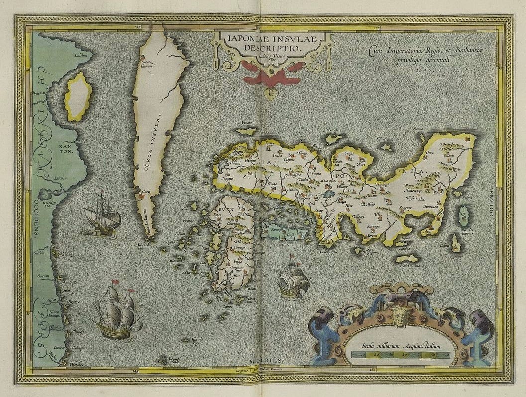
Both Japan and the Korean peninsula look rather misshapen, which is to be expected at this time in cartographic history.
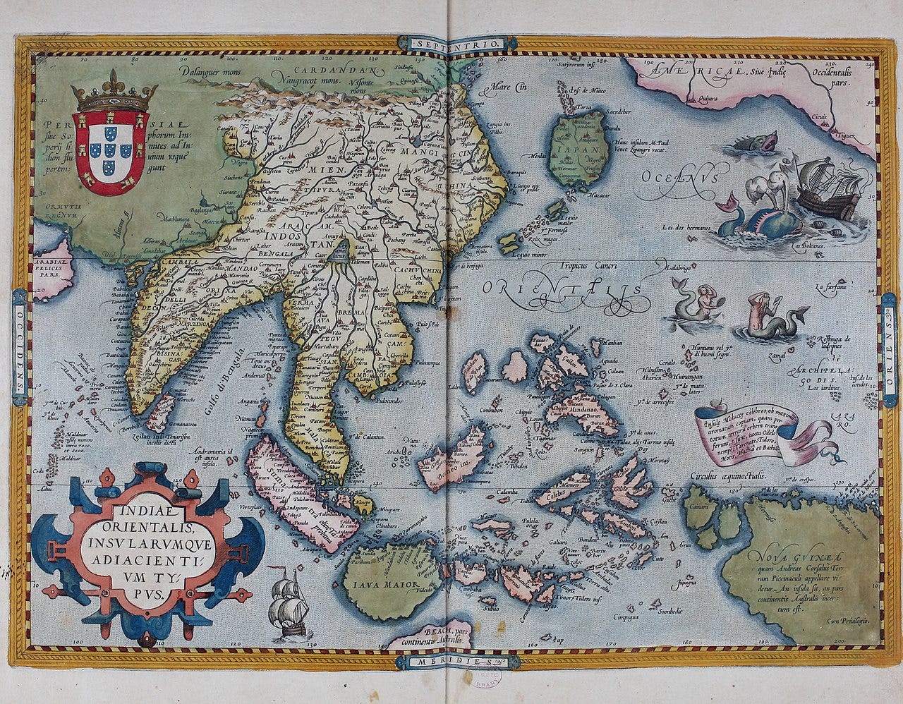
Merpeople doing their hair in the Pacific, scary sea monsters rocking ships — what’s not to love about this map of East Asia!

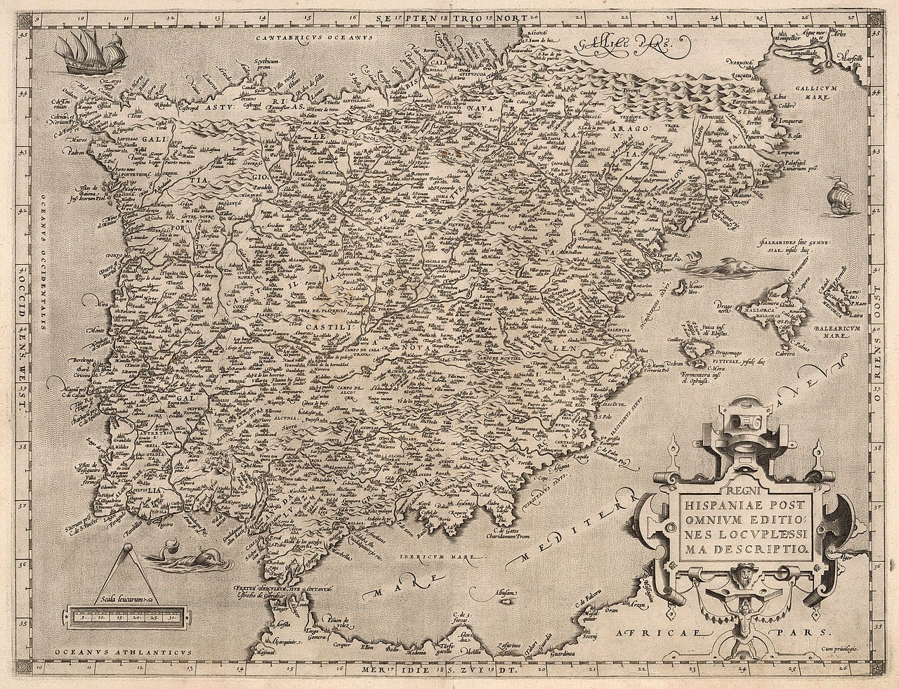
Americas
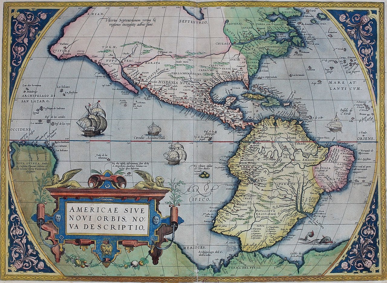
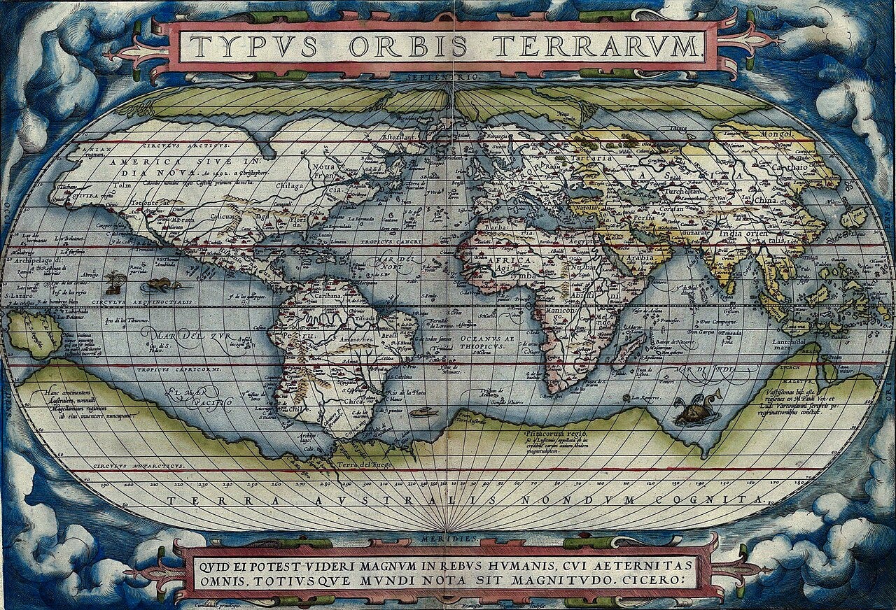
Ortelius has correctly drawn California as a peninsula, rather than an island, as was common at the time. Notice also the long-rumoured ‘Terra Australis’ (Southern Continent), first postulated by Ptolemy in 1st century AD, in green at the bottom. This is not to be mistaken for Antarctica, which wasn’t discovered for another two hundred years. Look how much of North America is blank. Bonus points if you can find El Dorado somewhere on the map.
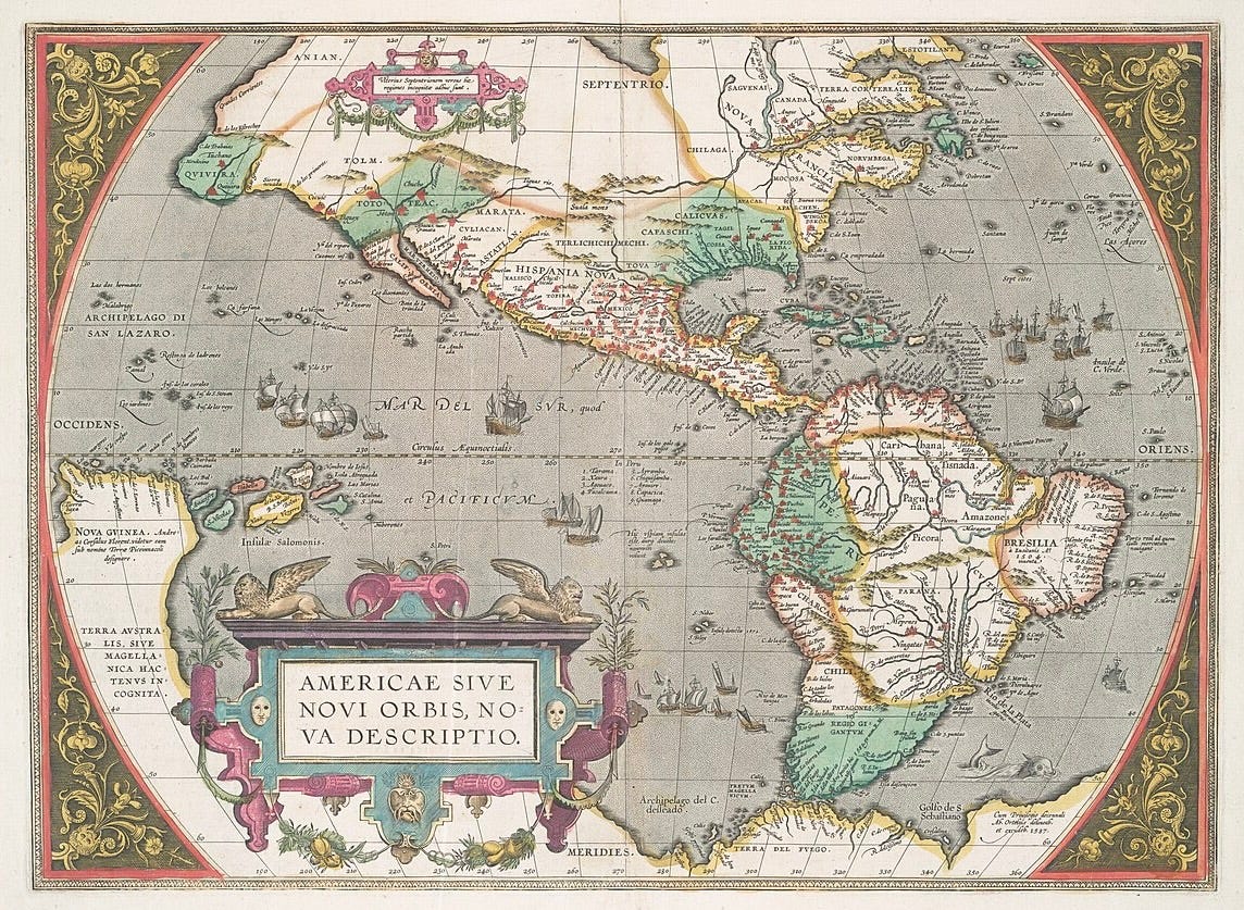
New Guinea is rather big, but we get a glimpse of the Great Wall of China in the upper left. This comes from an edition of Theatrum 19 years after the one above, and if anything the depiction of the Americas has gotten less accurate.
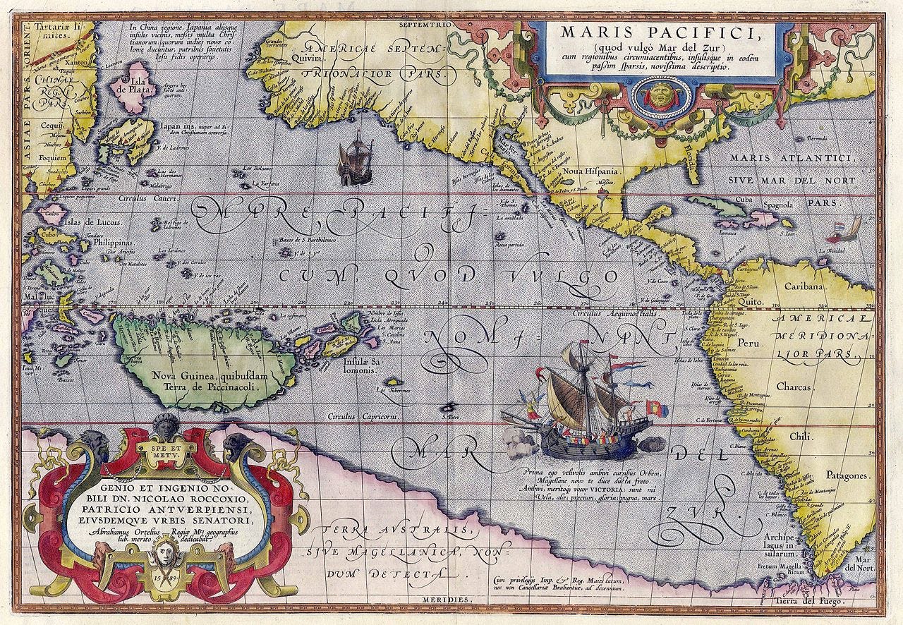
A year later and we’ve regained some accuracy and a lot more detail. Notice Anian has crept over to the northeast of North America, which alludes to the hope for a Northwest Passage over the top of the Americas.

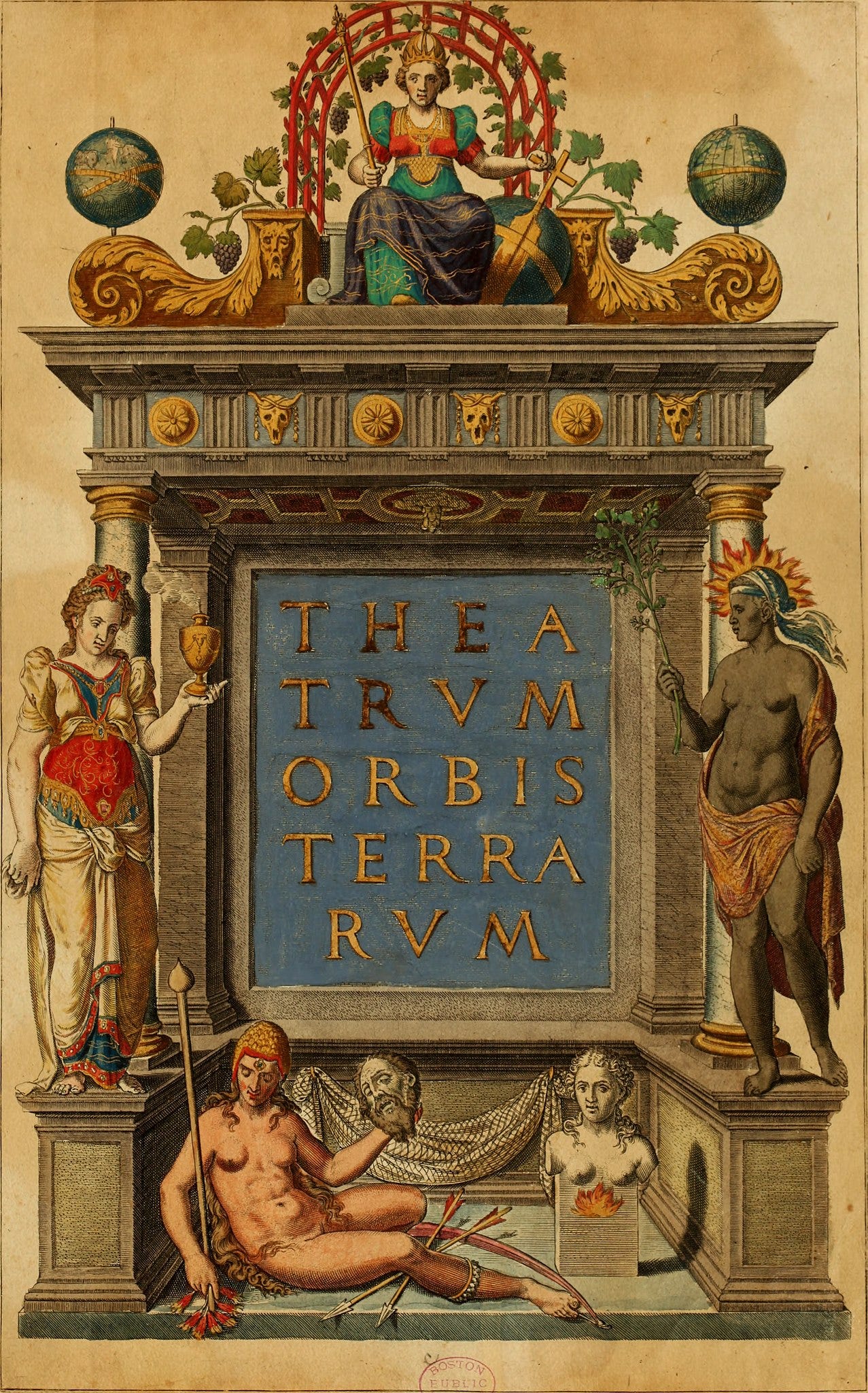
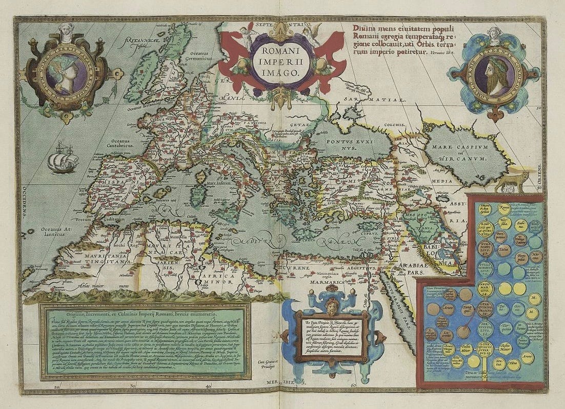
The title page is a reminder of the times. The four known continents are depicted as women: Europe reigns supreme at the top, while Africa radiates the power of the sun to her left, and Asia stands on her right holding spices. A ‘barbaric’ America lies at the very bottom, nude and holding the head of European. Next to her lies a bust of Magellan to represent the southern portion of the continent. It leaves no doubt as to who the Europeans believed ruled the ‘Theatre of the World’.
Mercator himself had actually been accused of heresy and imprisoned for eight months for the apparent Lutheranism detectable in his work.
Great piece!
It's an exraordinary achiement, but our favourite map maker remains Copernicus
I love this post! I’ve been exploring the field of cartography since beginning college because it is oddly my new obsession and I want these ancient maps on my walls so bad