

Yukon River
Atlas’ Notebook: Edition LIX

Welcome to Cosmographia. The following is part of our Atlas’ Notebook series, featuring art, poetry, literature, cartography, and photography, all centred on a particular place. For the full map of Cosmographia posts, see here.
The Gwichʼin First Nation of Canada refer to the second longest river in Canada, and third longest in the United States, as chųų gąįį han — white water river. This phrase can be shortened to ųųg han, pronounced Yuk Han. Thus, the Yukon gets its name from the colour of the glacial runoff that feeds its upper course.
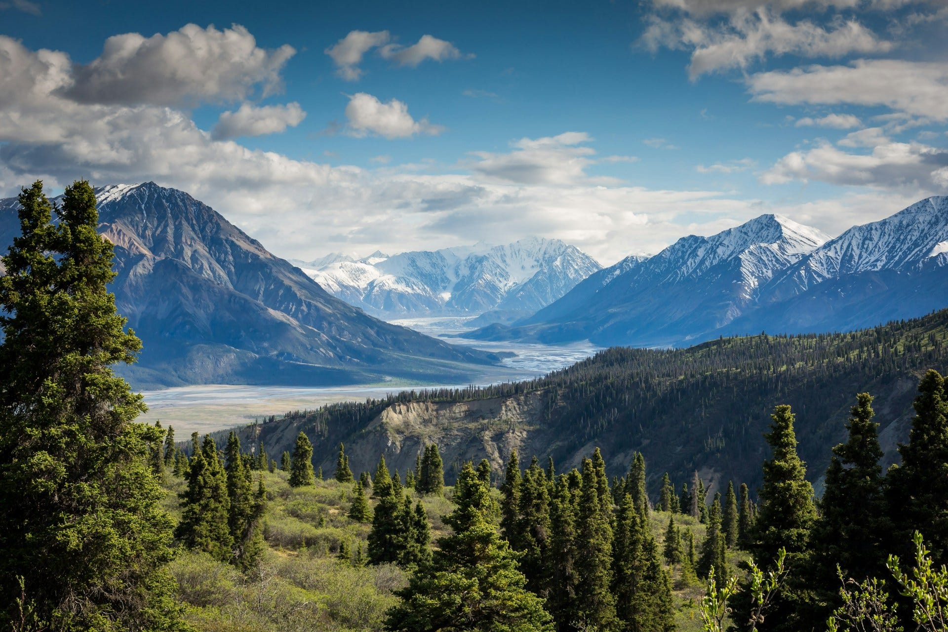
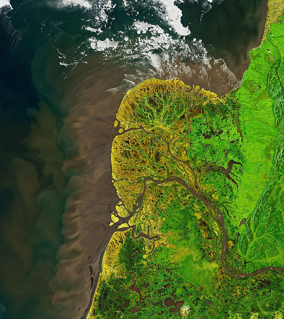
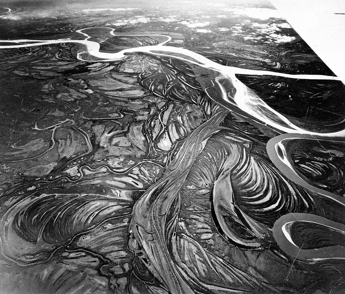
For almost 2000 mostly westward miles, the river meanders through the boreal forests of Yukon and central Alaska, before eventually disgorging its flow into the icy waters of the Bering Sea. In its path from Llewellyn Glacier in British Columbia to the Yukon–Kuskokwim Delta on the westernmost coast of continental United States, the river drains a land area 25% larger than the State of Texas.
It is a testament to the river’s inaccessibility amid the frozen forests of the north, that I found it harder than usual to find artworks and photographs for this edition of Atlas’ Notebook. It gives me hope that some wildernesses still exist after all.

I. In Art
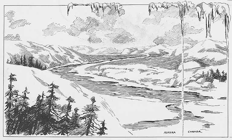
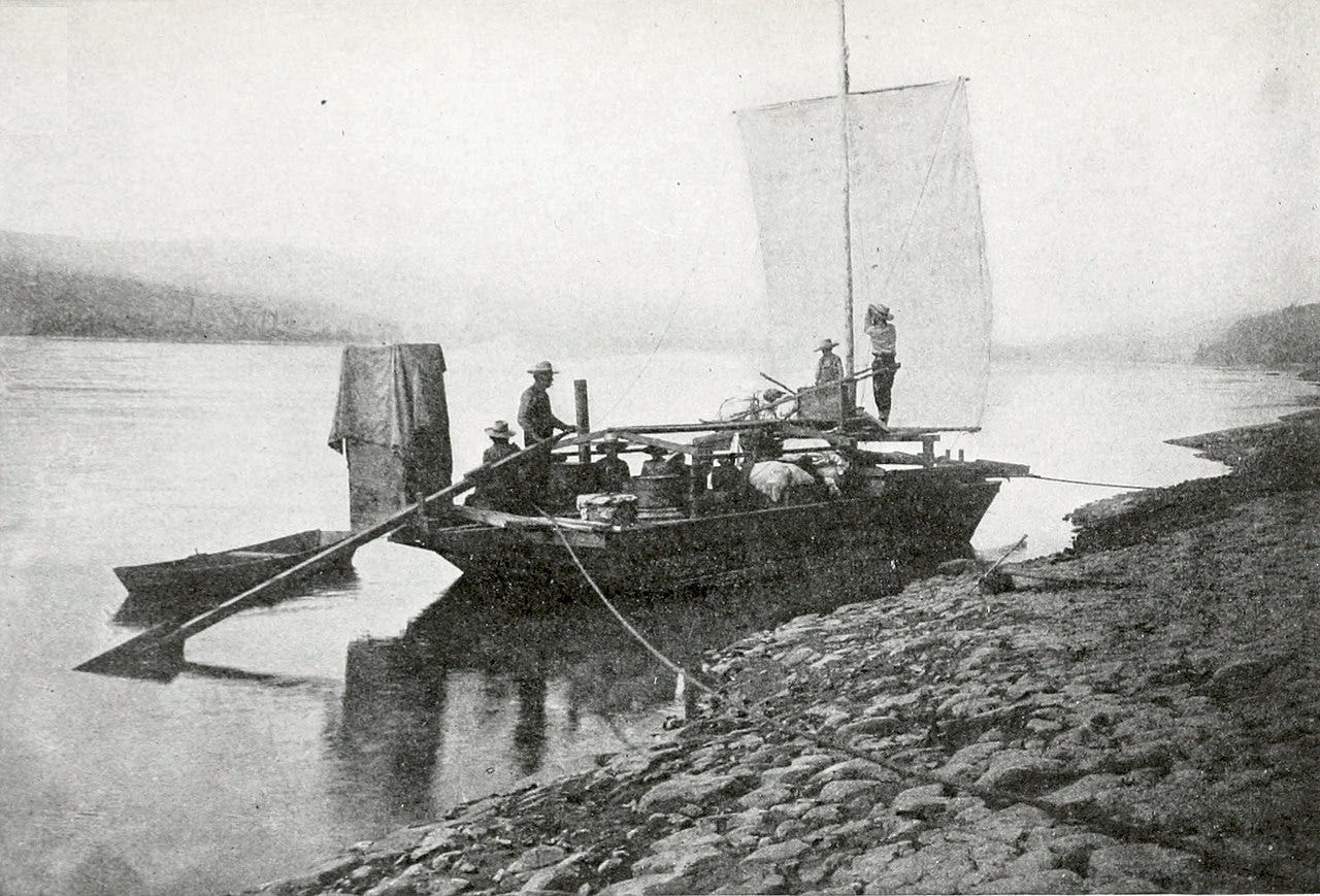
This sketch comes from the book, Klondike: A Manual for Goldseekers (1897). In August 1896, gold was discovered in the Klondike region of Yukon, in northwestern Canada. When news reached the West Coast cities of Seattle and San Francisco the following year, it precipitated a deluge of prospectors flooding north in the hopes of making a fortune. An estimated 100,000 dreamers set out for Klondike, but such were the hardships of the journey that only 40,000 or so actually made it to their destination. After enduring the bitter cold, the treacherous mountain passes, and the ice-packed Yukon, those who made it to journey’s end were mostly disappointed. Only a lucky few found gold.

II. In Verse
This is the law of the Yukon, and ever she makes it plain:
'Send not your foolish and feeble; send me your strong and your sane
Strong for the red rage of battle; sane, for I harry them sore;
Send me men girt for the combat, men who are grit to the core;
Swift as the panther in triumph, fierce as the bear in defeat,
Sired of a bulldog parent, steeled in the furnace heat.
Send me the best of your breeding, lend me your chosen ones;
Them will I take to my bosom, them will I call my sons;
Them will I gild with my treasure, them will I glut with my meat;
But the others—the misfits, the failures — I trample under my feet.
Dissolute, damned and despairful, crippled and palsied and slain,
Ye would send me the spawn of your gutters — Go! take back your spawn again.
— Robert W. Service, The Law of the Yukon (1907)
Robert W. Service, a Scottish-Canadian writer and poet, has been called the ‘Bard of the Yukon’. Service was born in Lancashire, England to Scottish parents. After some years working in Glasgow as a bank teller, inspired by Rudyard Kipling and Robert Louis Stevenson, he set sail for the Yukon wilderness, hoping to work as a cowboy. He would arrive a few years after the Goldrush had ended, but was so enamoured with the story he spent years gleaning the material that would eventually inform his poetry and novels.

III. In Cartography
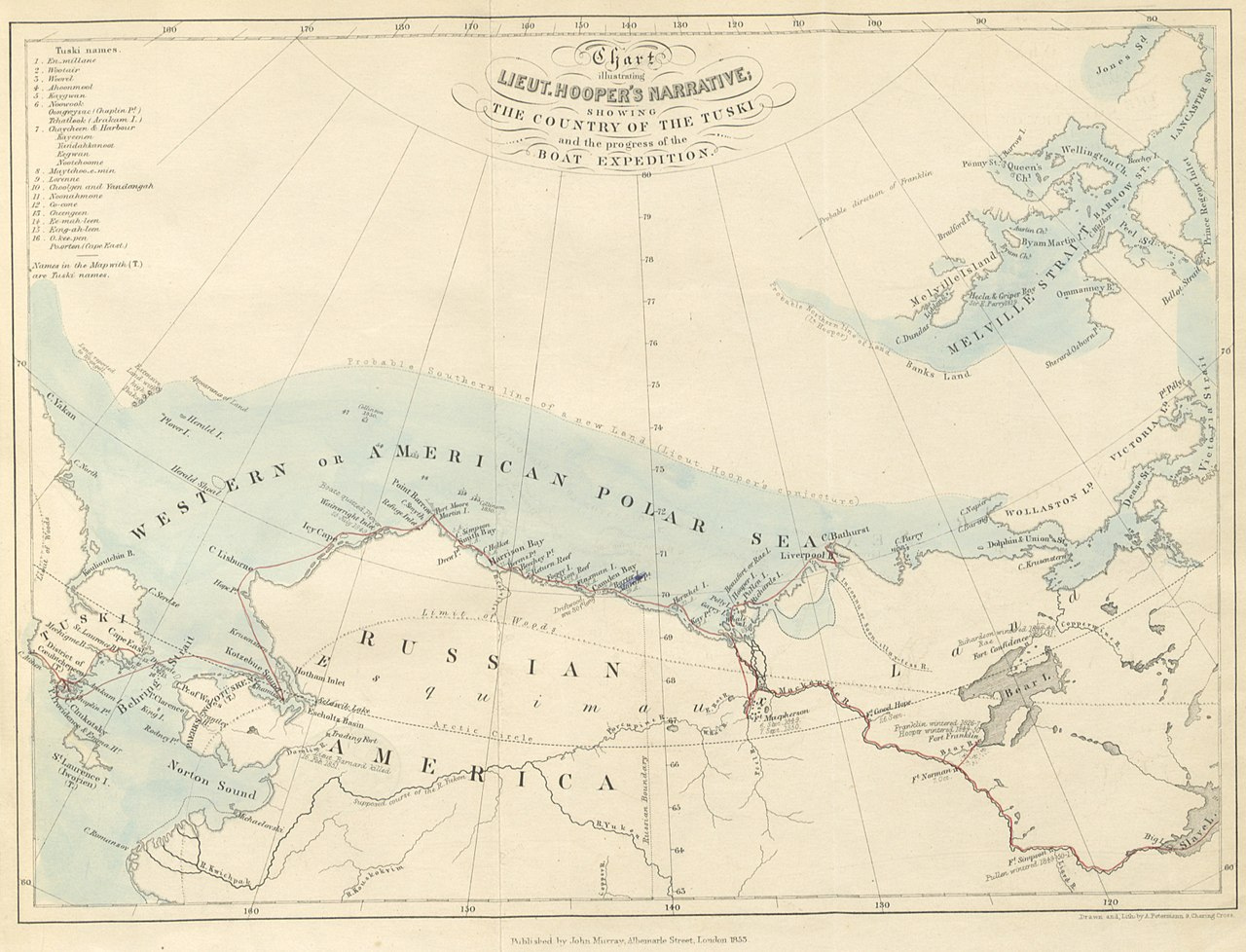
William Hulme Hooper was a British naval officer and Artic explorer. In 1848, he was among the crew of the HMS Plover as it sailed out from Plymouth, England, on a mission to find the missing men of Sir John Franklin's ill-fated Northwest Passage expedition of 1845. They would never find them. When wintering in Providence Bay, Siberia, they did, however, fall in with the indigenous Chukchi people, about whom he wrote the book from which this map comes.
We can see Hooper’s expedition route marked here in red. They sailed round the north of Alaska before heading inland up the Mackenzie River looking for Franklin and his men. This part of Canada, with its vast boreal forest and tundra, is thinly populated even now; they must have felt they were at the ends of the earth.
The Yukon is the other great river on this map, its delta beginning at the bottom left, within “Russian America”. I love the honesty of the label “Supposed Course of the R. Yukon,” which gives you a sense of how little they knew of the territory they were heading into. The Artic ice shown is also just a guess; they still hoped for a Northwest passage.
Three Artic winters clearly took their toll on Hooper’s health, for he would die in 1854, aged just 27.

IV. In Literature
The Yukon River, which the explorers ascended six hundred miles, is one of the greatest streams in the world. The Amazon, the Mississippi, and perhaps the La Plata, alone surpass it. For a distance of seventeen hundred miles from its mouth, its average width is more than a mile, and while it courses through the centre of Alaska, it rises far to the south in British America, near the sources of the Mackenzie. The larger portion of it is frozen over during eight months of the year, but in summer it is navigable far above Fort Yukon. Its course in Alaska is mainly toward the west, but at Nulato, the most northernly trading-post of the Russians, it turns and flows toward the south, and falls into the sea just south of Norton's Sound.— Alexander Hyde et al., from The Frozen Zone and its Explorers (1874)
I found this quote in an obscure 19th century book on the history of exploring the frozen poles of our Earth. Who Alexander Hyde and his co-authors were I’m not sure; I can find no information about them anywhere aside from a few other titles on varied and disparate topics.

V. In Photography
.jpg)
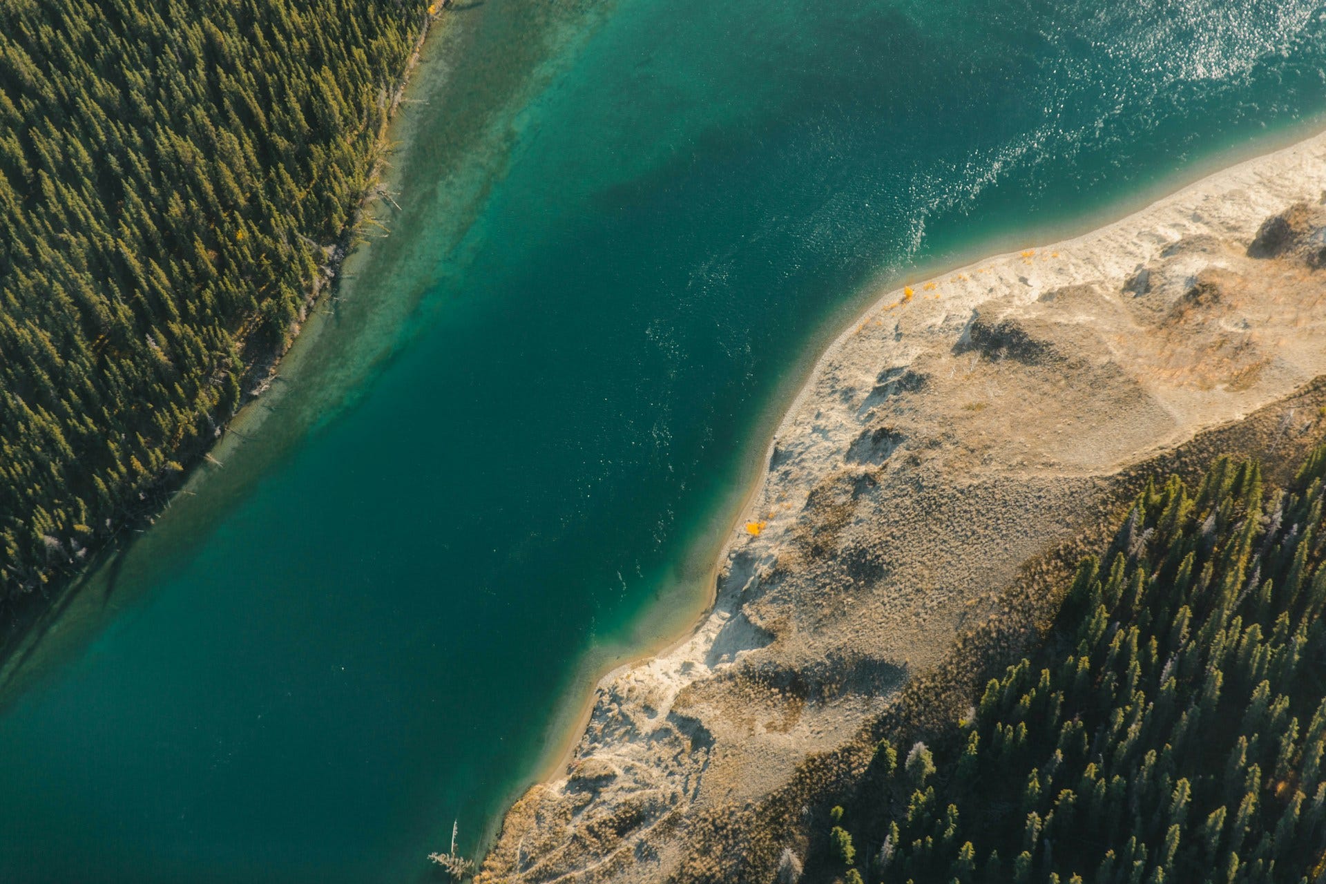


The Yukon is the longest salmon run in the world. Some king salmon, after spending their lives deep in the Pacific, will travel two thousand miles against the current to return to the spawning grounds of their birth. Navigating by their sense of smell, they will find the exact same pools where they were hatched, to spawn themselves and then to die, exhausted by their journey.— Adam Weymouth

Sitka, AK is a popular cruise ship port during the summer cruise season. I took a van excursion to Carcross in Yukon Territory and the road goes along the shore of Lake Bennett where the Klondikers built rafts or small boats to float down the Yukon River to the supposed goldfields.
Carcross holds the remains of a small steamboat that was carried piecemeal up the trail and built on the lake. For many years the steamboat was beached and slowly decomposing until an arsonist decided to burn it. The Territorial govt has restored some of it, but seeing 120 year old steam engine works is very interesting.
Carcross (original name was Caribou Crossing) was the home of “Skookum Jim”, a First Nations man credited by many with discovering the gold nuggets that set off the 1898 Gold Rush.
Thanks for doing this one. I’ve always had a strange nostalgia for this area always slightly north of me and never having the chance to fulfill the dream of a visit.